Archipelagos’ GIS & remote sensing internships provide an opportunity to join year-round research, offering experience in a range of data collection methods as well as exposure to a scope of GIS platforms and mapping techniques. Our main area of focus, the Aegean Sea, is one of the most important remaining marine biodiversity hotspots in the Mediterranean and Europe but exposed to significant human interactions. Archipelagos’ research is dedicated to addressing data gaps in this area aiming to enable efficient conservation action. Through the use of field surveys (boat and kayak-based), remote sensing and drone monitoring, you will be contributing to the necessary production of accurate maps with a mission to support effective management and conservation of these incredible habitats.
Key Projects
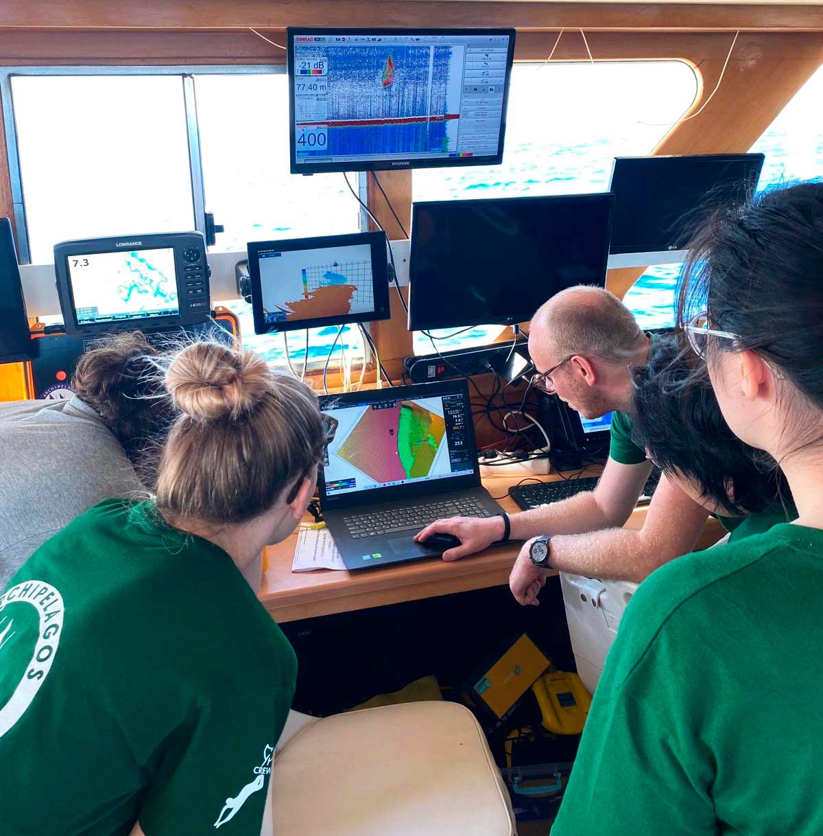
Mapping mesobenthic habitats by conducting a rapid-assessment mapping technique. Archipelagos combines citizen science with echosounder and ROV data collected on board of the R/V Aegean Explorer, to gain insight into coralligenous and other mesobenthic habitats’ presence.
Monitoring the anthropogenic presence and impact on marine systems. Using a wide range of external spatial data, we analyse the bottom trawling and marine traffic intensity and risks for the Aegean Sea.
Assessing the distribution of seagrass meadows in the coastal zones around the Aegean Sea. Research is focused on remote sensing methodologies combined with training data obtained from downscan sonar kayak surveys or snorkel surveys.
Monitoring of individual cetaceans through the use of photo-ID techniques. Analysis tracking changes in distribution and abundance for resident and migratory populations.
Monitoring environmental change in marine environments. Throughout remote sensing observations we aim to monitor long-term and seasonal variations in the environment, proxies important for our other research teams.
Develop awareness raising material. As a part of our conservation efforts we work to develop high-quality maps to inform national and EU authorities as well as the public on the results of research findings.
Background
The Aegean Sea is one of the most important marine biodiversity hotspots in the Mediterranean, hosting immense biodiversity and keystone species in the most extensive and pristine seagrass meadows and coralligenous assemblages. Unfortunately, these ecosystems are at increasing risk of irreversible destruction due to anthropogenic activities, such as illegal fishing, tourism and climate change, while the legislation in place for their conservation is not being enforced. The fundamental prerequisite in the attempt to protect these essential habitats is the fabrication of accurate distribution maps and monitoring the human impact on the marine ecosystems. For this reason, Archipelagos works to bridge key knowledge gaps by combining multiple data sources as a contribution to our teams’ science for conservation efforts.
Your Role
The internship will consist of both fieldwork at sea and office work, which will help you to gain a valuable skill set in data collection and analyses from an array of scientific tools and existing datasets. You are providing support to different projects related to the conservation of the Aegean Sea and her islands. As Archipelagos is continually improving the data collection and conservation outputs, you will be encouraged to explore new ideas. You will be offered the ability to work in a general intern role collaborating on current research topics, or in a specialized intern role contributing to one pre-defined project.
What we offer
We offer an internship at an inspiring institute with experts on applied conservation. You have the opportunity to collect data for writing a thesis, scientific publications or increasing your skill set. Internships normally range from 3 – 12 months, although shorter or longer internship periods may be arranged on a case by case basis . As Archipelagos is a non-profit organisation, the internships we offer are unpaid. Students, recent graduates and researchers are advised to search for possible funding through their universities, via their International Office/ Placement/ Erasmus+ Offices at their Universities or other relevant grant providing organizations in their region, to cover their travel and living costs.
Technical Skills
At least one of the following requirements is needed:
GIS: Good experience with GIS software (e.g. QGIS, ArcGIS);
Remote Sensing: Good experience with Remote Sensing packages (e.g. SNAP, ENVI, ErDAS);
Data analyses: Experience in R or Python for spatial statistics.
Other Skills
Fluency in English
Good communication skills
Ability to work in a multicultural environment
Motivation to live in remote places with simple facilities
Sincere desire to work towards Archipelagos’ conservation efforts
To apply for this internship click ‘Apply Now!’ and follow subsequent steps! For any questions please contact our admissions team at – admissions@archipelago.gr – and we will get back to you within 2 working days.