 Inge joined the Archipelagos GIS team in April 2019 for a research internship to complete her Master’s degree in Geographical Information Management and Application at the University of Utrecht, in the Netherlands. She uses spatial data and geo-information as a key tool in providing answers to complex issues concerning the conservation of our environment, since spatial analysis is able to provide a better understanding of habitats and species.
 Her main project is the mapping of Posidonia Oceanica seagrass meadows, in order to protect these valuable marine ecosystems from degradation mainly caused by anthropogenic impacts. The GIS team combines Geographical Information Systems (GIS) with the processing of satellite imagery to derive information about the locations of these seagrass meadows. Distribution models, including habitats, species and vulnerability, are the final output of their work. Inge, specifically, focuses on the technical methodology of the classification of the satellite imagery, with the overarching goal of optimizing the method to improve the accuracy.
 The Regional Activity Centre for Specially Protected Areas (SPARAC) is a major player in the seagrass project. Archipelagos carries out extensive research to map the distribution of P. Oceanica around nine islands in the Southeast Aegean Sea. Inge played an important role in this research by collecting data in the field and modeling this data into useful information. Several of her maps have been used in the final report for SPARAC.
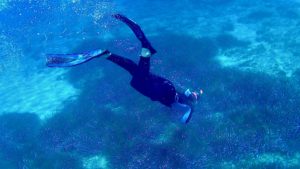
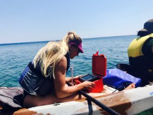
The data that is used in this research is often obtained by means of surveys at sea using Archipelagos’ research vessels. Inge is frequently aboard the Aegean Explorer collecting data. The combination of technical GIS work with the practical and physical endeavor that comes with living and working on a boat is a new experience that she fully enjoys. During the trips, the team is dropped off at the coast of islands in the Southeast Aegean Sea to perform measurements by means of kayak surveys. A single beam sonar is installed on the back of the kayak to measure the seafloor and detect seagrass. Later on in the process, this data is used in different software solutions to create the final distribution models.
Since geo-information is a broad concept and very useful to a wide range of disciplines, Inge is a big help to multiple projects within the different Archipelagos’ teams. The environmental data that is collected during surveys need to be mapped and analyzed in more detail in order to achieve effective environmental preservation in the Eastern Aegean Islands. For example, Inge contributed to the Archipelagos jackal team by making overview maps displaying the locations of their camera traps; she processed data about seabird species in GIS to explicit maps and, in addition, she mapped the brackish water pond where various important species live, including terrapins and endangered eels. The maps that Inge creates are used by many colleagues in their reports.

In addition to all the practically acquired knowledge, Inge learned a lot about herself, different cultures and life in general by working and living together with students and staff from all over the world. Reflecting on her internship she says: ‘I feel very honored being part of such an inspiring and hardworking team that is committed to what they admire the most: the marine life. It makes me proud that our crew originates from more than 30 different countries, who all have travelled to Greece to share their knowledge and skills for marine conservation’.